GEO-Instruments are delivering the long-term instrumentation and monitoring contract for the tunnelling part of the London Power Tunnels 2 (LPT2) project in south London.

The project
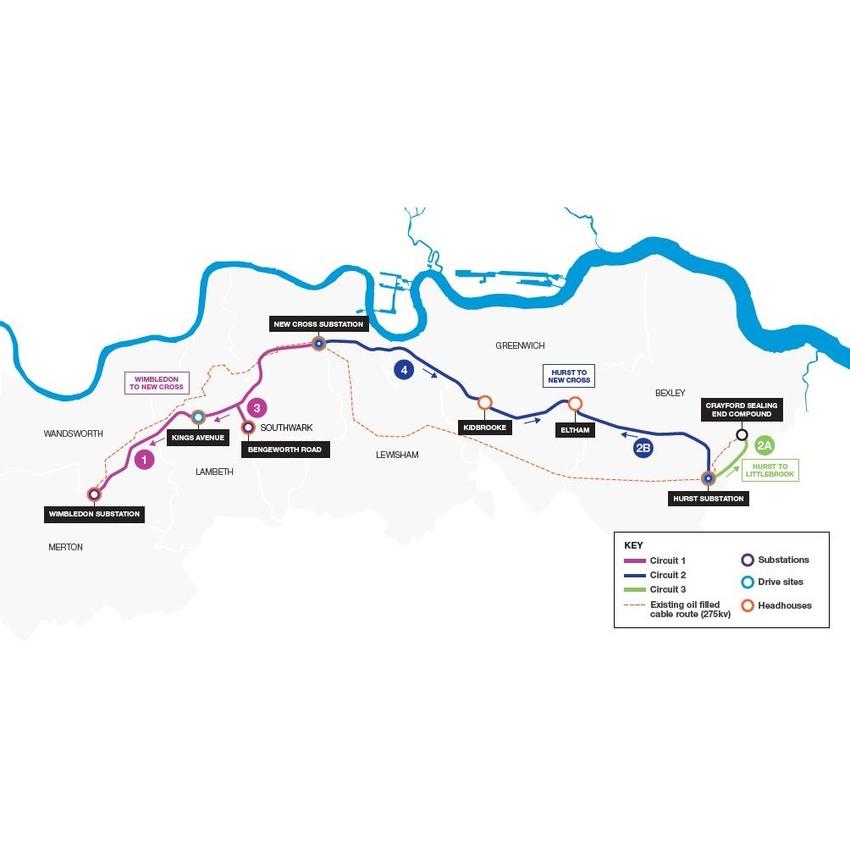
LPT2 is a network of new cable tunnels being built across south London between Wimbledon and Crayford. It’s the second phase of a National Grid project to improve London’s power infrastructure, the first phase took place north of the Thames and was completed in 2018.
Four Tunnel Boring Machines (TBMs) will complete five tunnelling drives starting with the section running from Kings Avenue (Brixton) to Wimbledon.
The challenge
This large scale and long-term project requires the construction of 32.5 kilometres of tunnel underneath heavily developed parts of London.
To effectively cover the scope of the works, the monitoring package needs to be carefully planned and managed to make sure teams and instrumentation are in the right place at the right time.
In total there are more than 20 separate interfaces that require detailed monitoring. Asset holders include London Underground, DLR, UKPN and Network Rail.
The solution
Working with main contractor HOCHTIEF-MURPHY Joint Venture, GEO-Instruments will provide a complete monitoring package for the full course of the new tunnels that will be constructed.
A range of automated and manual solutions will be installed to monitor road infrastructure and 3rd party assets that cross the route of the TBMs.
The package includes the supply of visualisation software to store manual and automated monitoring data, plot graphs and track TBM progress.
Four TBM drives will be running simultaneously with tunnelling data being fed into the QuickView database so the progress of each drive is updated in the software in near real-time. This regular feedback of TBM position and monitoring data to will allow the project team to easily display and understand the influence of the tunnel construction. Over 3000 Precise Levelling Points are being used, covering the length of the TBM routes.
This software feature will also aid planning as survey teams follow the advancement of the tunnel and undertake daily levelling runs determined by the current monitoring extents. Monitoring will continue until the completion of works in 2026.
